
Bura topographic map
Interactive map
Click on the map to display elevation.
About this map
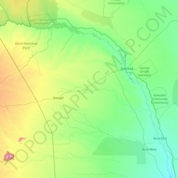
Name: Bura topographic map, elevation, terrain.
Location: Bura, Tana River County, Coast, Kenia (-1.28934 38.42083 -0.00398 40.04060)
Average elevation: 282 m
Minimum elevation: 63 m
Maximum elevation: 1,316 m