
Thank you for supporting this site ❤️
Make a donation
Make a donation
Samarda topographic map
Click on the map to display elevation.
Thank you for supporting this site ❤️
Make a donation
Make a donation
About this map
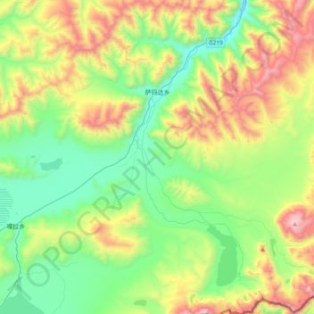
Name: Samarda topographic map, elevation, terrain.
Location: Samarda, Kangmar County, Shigatse Prefecture, Tibet, China (28.16835 89.42614 28.50194 89.79295)
Average elevation: 4,820 m
Minimum elevation: 4,303 m
Maximum elevation: 5,908 m
Thank you for supporting this site ❤️
Make a donation
Make a donation