
Thank you for supporting this site ❤️
Make a donation
Make a donation
Dhanore topographic map
Click on the map to display elevation.
Thank you for supporting this site ❤️
Make a donation
Make a donation
About this map
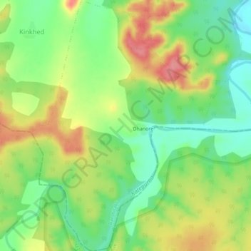
Name: Dhanore topographic map, elevation, terrain.
Location: Dhanore, Barshitakli, Akola, Maharashtra, India (20.37976 77.13064 20.41994 77.16393)
Average elevation: 388 m
Minimum elevation: 349 m
Maximum elevation: 435 m
Thank you for supporting this site ❤️
Make a donation
Make a donation