
Thank you for supporting this site ❤️
Make a donation
Make a donation
Brushy topographic map
Click on the map to display elevation.
Thank you for supporting this site ❤️
Make a donation
Make a donation
About this map
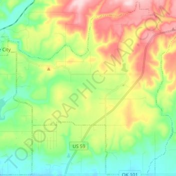
Name: Brushy topographic map, elevation, terrain.
Location: Brushy, Sequoyah County, Oklahoma, United States (35.50700 -94.81393 35.60834 -94.68728)
Average elevation: 269 m
Minimum elevation: 173 m
Maximum elevation: 419 m
Thank you for supporting this site ❤️
Make a donation
Make a donation
Other topographic maps
Click on a map to view its topography, its elevation and its terrain.