
Innerthal topographic map
Interactive map
Click on the map to display elevation.
About this map
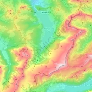
Name: Innerthal topographic map, elevation, terrain.
Location: Innerthal, March, Svitto, 8858, Svizzera (47.02002 8.86742 47.11880 8.97598)
Average elevation: 1,380 m
Minimum elevation: 746 m
Maximum elevation: 2,277 m