
Wallerfangen topographic map
Interactive map
Click on the map to display elevation.
About this map
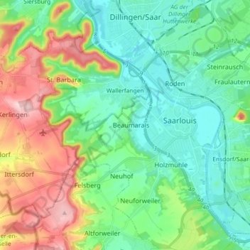
Name: Wallerfangen topographic map, elevation, terrain.
Location: Wallerfangen, Landkreis Saarlouis, Saarland, 66798, Duitsland (49.27980 6.58910 49.34963 6.73264)
Average elevation: 236 m
Minimum elevation: 170 m
Maximum elevation: 386 m