
seehore topographic map
Interactive map
Click on the map to display elevation.
About this map
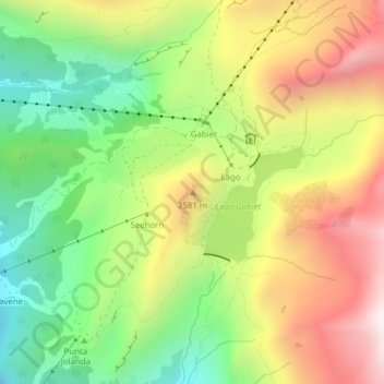
Name: seehore topographic map, elevation, terrain.
Location: seehore, Gressoney-La-Trinité, Valle d'Aosta, Italië (45.85050 7.84372 45.85060 7.84382)
Average elevation: 2,360 m
Minimum elevation: 1,918 m
Maximum elevation: 2,889 m
Other topographic maps
Click on a map to view its topography, its elevation and its terrain.
Piramide Vincent
Italië > Valle d'Aosta > Gressoney-La-Trinité
Piramide Vincent, Gressoney-La-Trinité, Valle d'Aosta, Italië
Average elevation: 3,758 m