
Thank you for supporting this site ❤️
Make a donation
Make a donation
Hola topographic map
Click on the map to display elevation.
Thank you for supporting this site ❤️
Make a donation
Make a donation
About this map
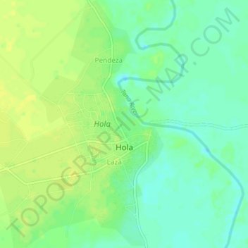
Name: Hola topographic map, elevation, terrain.
Location: Hola, Tana River County, Coastal Kenya, 70101, Kenya (-1.51375 40.01105 -1.47430 40.04121)
Average elevation: 63 m
Minimum elevation: 53 m
Maximum elevation: 72 m
Thank you for supporting this site ❤️
Make a donation
Make a donation