
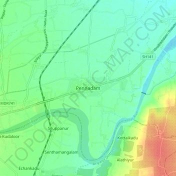
Pennadam topographic map
Interactive map
Click on the map to display elevation.
About this map
Name: Pennadam topographic map, elevation, terrain.
Average elevation: 49 m
Minimum elevation: 34 m
Maximum elevation: 81 m
Pennadam has an average elevation of 54 metres (177 feet). Sudarkozhundeeswarar Temple was built in the early Chola period. Pennadam is also the birthplace of Maigandanathar, one of the Nayanmars. A temple was also built for Maigandanathar in this town in the 20th century.
Other topographic maps
Click on a map to view its topography, its elevation and its terrain.
Tittakudi
India > Tamil Nadu > Tittakudi > Tittakudi
Tittakudi, Cuddalore District, Tamil Nadu, 606106, India
Average elevation: 65 m