
Thank you for supporting this site ❤️
Make a donation
Make a donation
Chennimalai topographic map
Click on the map to display elevation.
Thank you for supporting this site ❤️
Make a donation
Make a donation
About this map
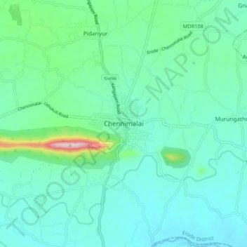
Name: Chennimalai topographic map, elevation, terrain.
Location: Chennimalai, Perundurai, Erode, Tamil Nadu, 638051, India (11.12432 77.56317 11.20432 77.64317)
Average elevation: 267 m
Minimum elevation: 212 m
Maximum elevation: 513 m
Thank you for supporting this site ❤️
Make a donation
Make a donation
Other topographic maps
Click on a map to view its topography, its elevation and its terrain.