
Orzydorf topographic map
Interactive map
Click on the map to display elevation.
About this map
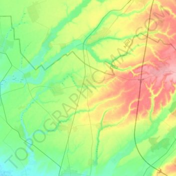
Name: Orzydorf topographic map, elevation, terrain.
Location: Orzydorf, Temesch, Rumänien (45.89195 21.07388 46.02014 21.36843)
Average elevation: 124 m
Minimum elevation: 86 m
Maximum elevation: 190 m
Other topographic maps
Click on a map to view its topography, its elevation and its terrain.
Charlottenburg
Charlottenburg, Neuhof, Temesch, 307073, Rumänien
Average elevation: 172 m