
Hwado topographic map
Interactive map
Click on the map to display elevation.
About this map
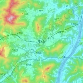
Name: Hwado topographic map, elevation, terrain.
Location: Hwado, Namyangju-si, Gyeonggi, South Korea (37.60449 127.25814 37.70216 127.37952)
Average elevation: 185 m
Minimum elevation: 23 m
Maximum elevation: 773 m