
Thank you for supporting this site ❤️
Make a donation
Make a donation
Wardsville topographic map
Click on the map to display elevation.
Thank you for supporting this site ❤️
Make a donation
Make a donation
About this map
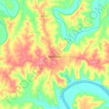
Name: Wardsville topographic map, elevation, terrain.
Location: Wardsville, Cole County, Missouri, United States (38.45962 -92.19559 38.52055 -92.16308)
Average elevation: 204 m
Minimum elevation: 159 m
Maximum elevation: 254 m
Thank you for supporting this site ❤️
Make a donation
Make a donation