
Thank you for supporting this site ❤️
Make a donation
Make a donation
Picung topographic map
Click on the map to display elevation.
Thank you for supporting this site ❤️
Make a donation
Make a donation
About this map
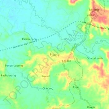
Name: Picung topographic map, elevation, terrain.
Location: Picung, Pandeglang, Banten, Java, Indonesia (-6.54545 105.93077 -6.46545 106.01077)
Average elevation: 35 m
Minimum elevation: 7 m
Maximum elevation: 102 m
Thank you for supporting this site ❤️
Make a donation
Make a donation
Other topographic maps
Click on a map to view its topography, its elevation and its terrain.