
Cala Murada topographic map
Interactive map
Click on the map to display elevation.
About this map
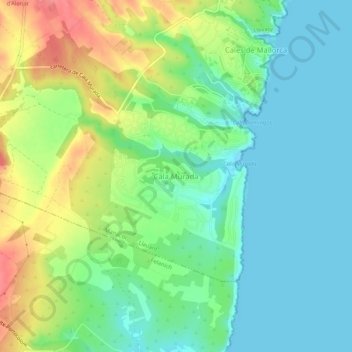
Name: Cala Murada topographic map, elevation, terrain.
Location: Cala Murada, Manacor, Llevant, Îles Baléares, 07670, Espagne (39.43082 3.24807 39.47082 3.28807)
Average elevation: 27 m
Minimum elevation: 0 m
Maximum elevation: 78 m
Other topographic maps
Click on a map to view its topography, its elevation and its terrain.
Artà
Espagne > Îles Baléares > Llevant
Artà, Llevant, Îles Baléares, 07570, Espagne
Average elevation: 119 m