
Hawai'i Volcanoes National Park topographic map
Interactive map
Click on the map to display elevation.
About this map
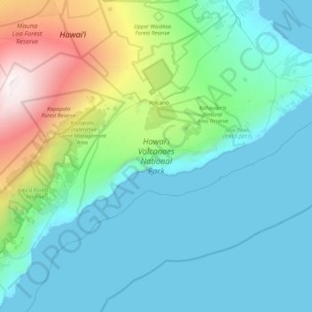
Name: Hawai'i Volcanoes National Park topographic map, elevation, terrain.
Average elevation: 688 m
Minimum elevation: 0 m
Maximum elevation: 4,163 m
Other topographic maps
Click on a map to view its topography, its elevation and its terrain.
Kīlauea
États-Unis d'Amérique > Hawaï > Hawaiʻi County
Kīlauea, Hawaiʻi County, Hawaï, 96718, États-Unis d'Amérique
Average elevation: 1,096 m