
Santa Fe topographic map
Interactive map
Click on the map to display elevation.
About this map
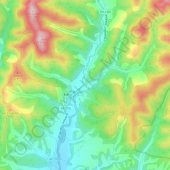
Name: Santa Fe topographic map, elevation, terrain.
Location: Santa Fe, Navarra, 31448, Spanien (42.75527 -1.26637 42.79527 -1.22637)
Average elevation: 662 m
Minimum elevation: 549 m
Maximum elevation: 834 m