
Puls topographic map
Interactive map
Click on the map to display elevation.
About this map
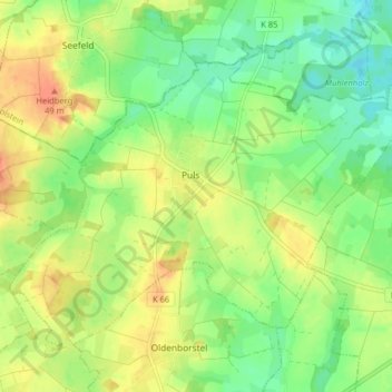
Name: Puls topographic map, elevation, terrain.
Location: Puls, Schenefeld, Steinburg, Schleswig-Holstein, Deutschland (54.06247 9.47940 54.09960 9.55960)
Average elevation: 26 m
Minimum elevation: 6 m
Maximum elevation: 49 m