
Make a donation
Arriate topographic map
Click on the map to display elevation.
Make a donation
Arriate
In spite of the scarcity of facts known about the history of Arriate, judging by the caves in the rocks on the banks of the river, it is possible that man's presence in these lands comes from very remote times. Its geographical situation in an area of soft topography and water, as well as the possibilities of hunting in the woods and nearby sierras, would have made it a very favourable place for the first hunters and later farmers.
Make a donation
About this map
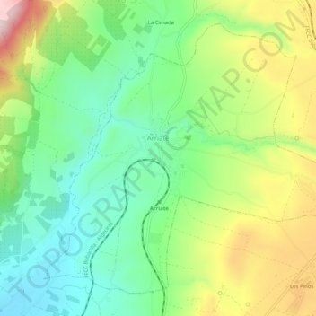
Name: Arriate topographic map, elevation, terrain.
Location: Arriate, Serranía de Ronda, Malaga, Andalusia, 29350, Spain (36.77911 -5.15915 36.81393 -5.10838)
Average elevation: 658 m
Minimum elevation: 514 m
Maximum elevation: 902 m
Make a donation
Other topographic maps
Click on a map to view its topography, its elevation and its terrain.