
Augusta topographic map
Interactive map
Click on the map to display elevation.
About this map
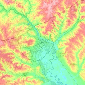
Name: Augusta topographic map, elevation, terrain.
Average elevation: 90 m
Minimum elevation: 25 m
Maximum elevation: 180 m
Other topographic maps
Click on a map to view its topography, its elevation and its terrain.
Windsor Spring
États-Unis d'Amérique > Géorgie > Augusta > Windsor Spring
Windsor Spring, Augusta, Richmond County, Géorgie, 30815-6609, États-Unis d'Amérique
Average elevation: 105 m