
Malta topographic map
Interactive map
Click on the map to display elevation.
About this map
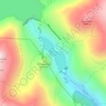
Name: Malta topographic map, elevation, terrain.
Location: Malta, Spittal an der Drau, Karinthië, 9854, Oostenrijk (47.06599 13.34221 47.07556 13.35081)
Average elevation: 2,028 m
Minimum elevation: 1,627 m
Maximum elevation: 2,533 m
Other topographic maps
Click on a map to view its topography, its elevation and its terrain.
Malta
Oostenrijk > Karinthië > Malta
Malta, Spittal an der Drau, Karinthië, 9854, Oostenrijk
Average elevation: 1,362 m