
Thank you for supporting this site ❤️
Make a donation
Make a donation
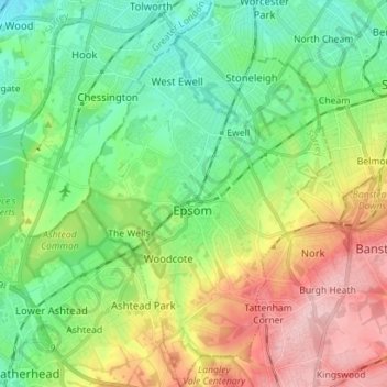
Epsom and Ewell topographic map
Click on the map to display elevation.
Thank you for supporting this site ❤️
Make a donation
Make a donation
Epsom and Ewell
The borough is at a range of elevations, scaling the lower slopes of the North Downs and drains into a large stream which springs above the surface in Ewell, the Hogsmill River which drains into the Thames at Kingston. The borough comprises.
Thank you for supporting this site ❤️
Make a donation
Make a donation
About this map
Name: Epsom and Ewell topographic map, elevation, terrain.
Location: Epsom and Ewell, Surrey, England, United Kingdom (51.29233 -0.30621 51.38022 -0.21729)
Average elevation: 73 m
Minimum elevation: 12 m
Maximum elevation: 181 m
Thank you for supporting this site ❤️
Make a donation
Make a donation