
Bajulan topographic map
Interactive map
Click on the map to display elevation.
About this map
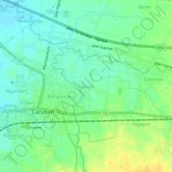
Name: Bajulan topographic map, elevation, terrain.
Location: Bajulan, Madiun, Jawa Timur, 63153, Indonésie (-7.56264 111.64836 -7.52264 111.68836)
Average elevation: 76 m
Minimum elevation: 65 m
Maximum elevation: 91 m