
Southern Pines topographic map
Interactive map
Click on the map to display elevation.
About this map
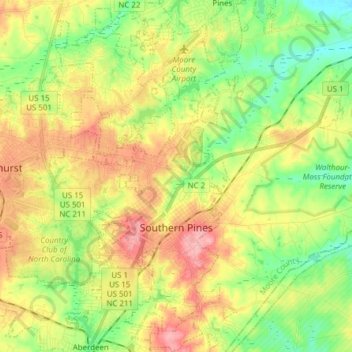
Name: Southern Pines topographic map, elevation, terrain.
Average elevation: 126 m
Minimum elevation: 75 m
Maximum elevation: 189 m
Other topographic maps
Click on a map to view its topography, its elevation and its terrain.
Aberdeen
Vereinigte Staaten von Amerika > Nord-Carolina > Moore County
Aberdeen, Moore County, Nord-Carolina, 28315, Vereinigte Staaten von Amerika
Average elevation: 128 m