
Birkenfeld topographic map
Interactive map
Click on the map to display elevation.
About this map
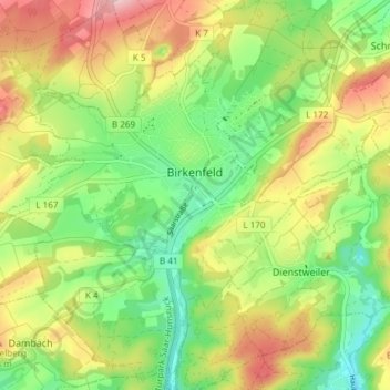
Name: Birkenfeld topographic map, elevation, terrain.
Location: Birkenfeld, Landkreis Birkenfeld, Rhineland-Palatinate, Germany (49.62178 7.12832 49.67014 7.20296)
Average elevation: 425 m
Minimum elevation: 341 m
Maximum elevation: 536 m