
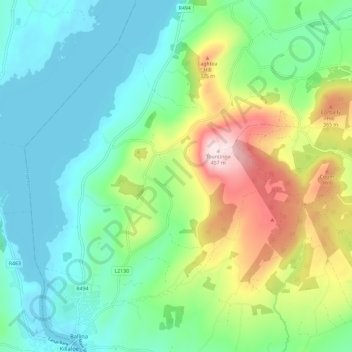
Derrycastle topographic map
Interactive map
Click on the map to display elevation.
About this map
Name: Derrycastle topographic map, elevation, terrain.
Average elevation: 152 m
Minimum elevation: 28 m
Maximum elevation: 455 m
Other topographic maps
Click on a map to view its topography, its elevation and its terrain.
The Municipal District of Nenagh
The Municipal District of Nenagh, County Tipperary, Munster, Irland
Average elevation: 116 m
Borrisoleigh
Irland > County Tipperary > Borrisoleigh
Borrisoleigh, The Municipal District of Thurles, County Tipperary, Munster, Irland
Average elevation: 128 m