
Estes Park topographic map
Interactive map
Click on the map to display elevation.
About this map
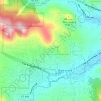
Name: Estes Park topographic map, elevation, terrain.
Average elevation: 2,409 m
Minimum elevation: 2,310 m
Maximum elevation: 2,636 m
Other topographic maps
Click on a map to view its topography, its elevation and its terrain.
Neota Wilderness
États-Unis d'Amérique > Colorado > Larimer County
Neota Wilderness, Larimer County, Colorado, États-Unis d'Amérique
Average elevation: 3,254 m
Rawah Wilderness
États-Unis d'Amérique > Colorado > Larimer County
Rawah Wilderness, Larimer County, Colorado, États-Unis d'Amérique
Average elevation: 2,898 m