
Kétésso topographic map
Interactive map
Click on the map to display elevation.
About this map
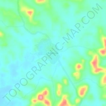
Name: Kétésso topographic map, elevation, terrain.
Location: Kétésso, Aboisso, Sud-Comoé, Comoé, Côte d’Ivoire (5.85796 -3.19407 5.89796 -3.15407)
Average elevation: 114 m
Minimum elevation: 88 m
Maximum elevation: 203 m
Other topographic maps
Click on a map to view its topography, its elevation and its terrain.
Toumanguié
Côte d’Ivoire > Comoé > Aboisso
Toumanguié, Aboisso, Sud-Comoé, Comoé, Côte d’Ivoire
Average elevation: 30 m
Maféré
Côte d’Ivoire > Comoé > Aboisso
Maféré, Aboisso, Sud-Comoé, Comoé, Côte d’Ivoire
Average elevation: 89 m