
Ambühren topographic map
Interactive map
Click on the map to display elevation.
About this map
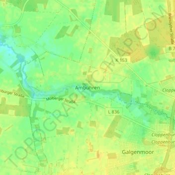
Name: Ambühren topographic map, elevation, terrain.
Average elevation: 40 m
Minimum elevation: 28 m
Maximum elevation: 48 m
Ambühren | Bethen | Cloppenburg (Kernbereich) | Emstekerfeld | Galgenmoor | Kellerhöhe | Staatsforsten | Stapelfeld | Sternbusch | Schmertheim | Vahren
Other topographic maps
Click on a map to view its topography, its elevation and its terrain.
Marienwallfahrtsort Bethen
Deutschland > Niedersachsen > Landkreis Cloppenburg > Cloppenburg
Marienwallfahrtsort Bethen, Cloppenburg, Landkreis Cloppenburg, Niedersachsen, 49661, Deutschland
Average elevation: 44 m