
Langenstein topographic map
Interactive map
Click on the map to display elevation.
About this map
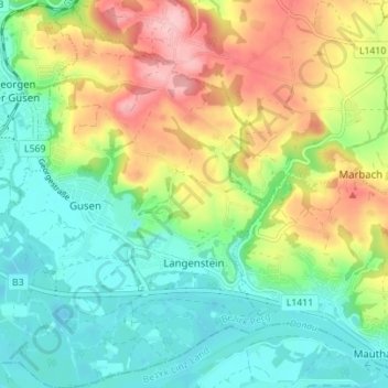
Name: Langenstein topographic map, elevation, terrain.
Location: Langenstein, Bezirk Perg, 4222, Österreich (48.23634 14.44056 48.28252 14.49503)
Average elevation: 293 m
Minimum elevation: 235 m
Maximum elevation: 391 m