
Sour El Ghozlane topographic map
Interactive map
Click on the map to display elevation.
About this map
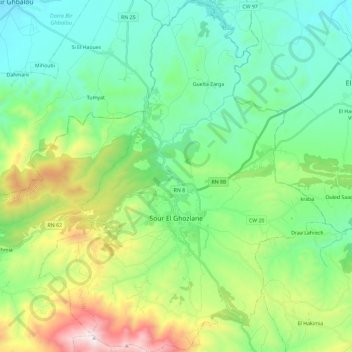
Name: Sour El Ghozlane topographic map, elevation, terrain.
Location: Sour El Ghozlane, Sour El Ghozlane District, Bouira, Algeria (36.07590 3.60055 36.26362 3.79039)
Average elevation: 934 m
Minimum elevation: 609 m
Maximum elevation: 1,807 m