
Krün topographic map
Interactive map
Click on the map to display elevation.
About this map
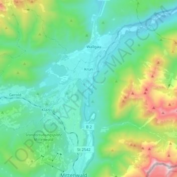
Name: Krün topographic map, elevation, terrain.
Location: Krün, Landkreis Garmisch-Partenkirchen, Baviera, Alemanha (47.44180 11.15763 47.54718 11.29596)
Average elevation: 1,198 m
Minimum elevation: 818 m
Maximum elevation: 2,455 m