
pang topographic map
Click on the map to display elevation.
About this map
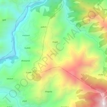
Name: pang topographic map, elevation, terrain.
Location: pang, Pauri, Pauri Garhwal, Uttarakhand, 246167, India (30.02361 78.84544 30.06361 78.88544)
Average elevation: 1,272 m
Minimum elevation: 812 m
Maximum elevation: 1,987 m