
Gföll topographic map
Interactive map
Click on the map to display elevation.
About this map
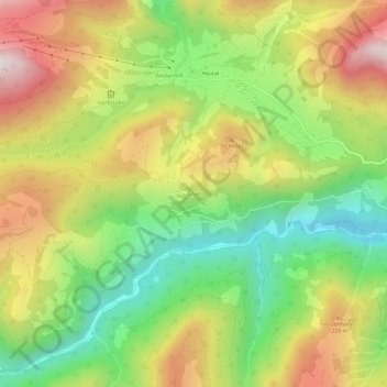
Name: Gföll topographic map, elevation, terrain.
Average elevation: 1,035 m
Minimum elevation: 654 m
Maximum elevation: 1,489 m
Other topographic maps
Click on a map to view its topography, its elevation and its terrain.
Niederland
Österreich > Salzburg > Bezirk Zell am See > Gemeinde Unken > Unken
Niederland, Unken, Gemeinde Unken, Bezirk Zell am See, Salzburg, 5091, Österreich
Average elevation: 843 m
Unken
Österreich > Salzburg > Bezirk Zell am See > Gemeinde Unken
Unken, Gemeinde Unken, Bezirk Zell am See, Salzburg, 5091, Österreich
Average elevation: 828 m