
Puente Fierro topographic map
Interactive map
Click on the map to display elevation.
About this map
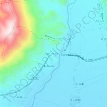
Name: Puente Fierro topographic map, elevation, terrain.
Location: Puente Fierro, José María Quimper, Camaná, Arequipa, Perú (-16.60525 -72.75547 -16.56525 -72.71547)
Average elevation: 124 m
Minimum elevation: 17 m
Maximum elevation: 608 m
Other topographic maps
Click on a map to view its topography, its elevation and its terrain.
Cerro San Cristobal
Perú > Arequipa > José María Quimper > Cerro San Cristobal
Cerro San Cristobal, José María Quimper, Provincia de Camaná, Arequipa, Perú
Average elevation: 136 m