
Thank you for supporting this site ❤️
Make a donation
Make a donation
Crâne topographic map
Click on the map to display elevation.
Thank you for supporting this site ❤️
Make a donation
Make a donation
About this map
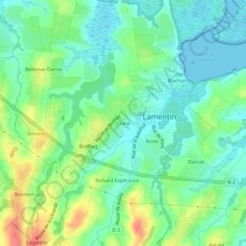
Name: Crâne topographic map, elevation, terrain.
Location: Crâne, Lamentin, Basse-Terre, Guadeloupe, 97129, France (16.24928 -61.65645 16.28928 -61.61645)
Average elevation: 21 m
Minimum elevation: 0 m
Maximum elevation: 62 m
Thank you for supporting this site ❤️
Make a donation
Make a donation