
Thank you for supporting this site ❤️
Make a donation
Make a donation
Perumpanachy topographic map
Click on the map to display elevation.
Thank you for supporting this site ❤️
Make a donation
Make a donation
About this map
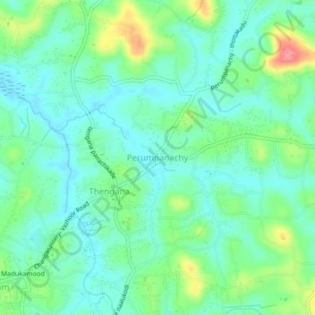
Name: Perumpanachy topographic map, elevation, terrain.
Location: Perumpanachy, Changanassery, Kottayam, Kerala, 686536, India (9.45850 76.56229 9.49850 76.60229)
Average elevation: 24 m
Minimum elevation: 0 m
Maximum elevation: 83 m
Thank you for supporting this site ❤️
Make a donation
Make a donation
Other topographic maps
Click on a map to view its topography, its elevation and its terrain.
Thank you for supporting this site ❤️
Make a donation
Make a donation
Sri Subramanya swami Kshethra Kulam, Perunna
India > Kerala > Changanassery > Changanassery
Average elevation: 6 m