
Oberhelfenschwil topographic map
Interactive map
Click on the map to display elevation.
About this map
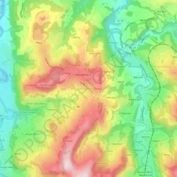
Name: Oberhelfenschwil topographic map, elevation, terrain.
Average elevation: 733 m
Minimum elevation: 561 m
Maximum elevation: 936 m
Other topographic maps
Click on a map to view its topography, its elevation and its terrain.
Tobelacker
Schweiz > Sankt Gallen > Wahlkreis Toggenburg > Neckertal > Oberhelfenschwil
Tobelacker, Oberhelfenschwil, Neckertal, Wahlkreis Toggenburg, Sankt Gallen, 9621, Schweiz
Average elevation: 726 m