
Burgettstown topographic map
Interactive map
Click on the map to display elevation.
About this map
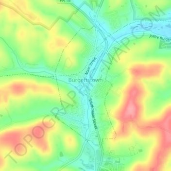
Name: Burgettstown topographic map, elevation, terrain.
Average elevation: 331 m
Minimum elevation: 290 m
Maximum elevation: 381 m
Other topographic maps
Click on a map to view its topography, its elevation and its terrain.
Monongahela
Vereinigte Staaten von Amerika > Pennsylvania > Washington County > Monongahela
Monongahela, Washington County, Pennsylvania, 15063, Vereinigte Staaten von Amerika
Average elevation: 286 m