Geolocate

Murumkheda topographic map

Click on the map to display elevation.

About this map

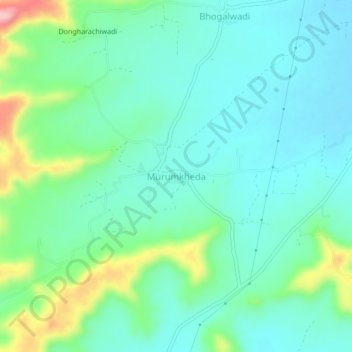
Name: Murumkheda topographic map, elevation, terrain.

Location: Murumkheda, Aurangabad, Maharashtra, India (19.92774 75.56503 19.96774 75.60503)

Average elevation: 623 m

Minimum elevation: 581 m

Maximum elevation: 750 m

Other topographic maps

Click on a map to view its topography, its elevation and its terrain.

Aurangabad

India > Maharashtra

Aurangabad, Maharashtra, 431002, India

Average elevation: 618 m

Daulatabad

India > Maharashtra > Aurangabad

Daulatabad, Aurangabad, Maharashtra, India

Average elevation: 618 m

Salim Ali Lake

India > Maharashtra > Aurangabad > Aurangabad

Salim Ali Lake, Aurangabad, Maharashtra, 431002, India

Average elevation: 590 m

In order to remain free and to keep improving, this site uses cookies created by Google to compile visit statistics and display personalized advertisements.

How is the collected data used?