
Thank you for supporting this site ❤️
Make a donation
Make a donation
La Russell topographic map
Click on the map to display elevation.
Thank you for supporting this site ❤️
Make a donation
Make a donation
About this map
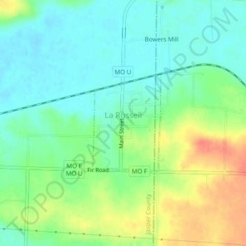
Name: La Russell topographic map, elevation, terrain.
Location: La Russell, Jasper County, Missouri, United States (37.13522 -94.06583 37.14595 -94.05643)
Average elevation: 329 m
Minimum elevation: 310 m
Maximum elevation: 361 m
Thank you for supporting this site ❤️
Make a donation
Make a donation
Other topographic maps
Click on a map to view its topography, its elevation and its terrain.