
Amola topographic map
Interactive map
Click on the map to display elevation.
About this map
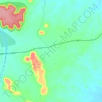
Name: Amola topographic map, elevation, terrain.
Location: Amola, Karera Tahsil, Shivpuri District, Madhya Pradesh, India (25.38498 77.92471 25.43752 77.96329)
Average elevation: 352 m
Minimum elevation: 317 m
Maximum elevation: 449 m