
Tapachula topographic map
Interactive map
Click on the map to display elevation.
About this map
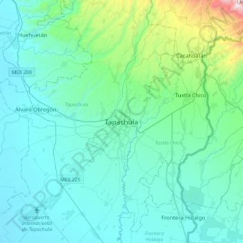
Name: Tapachula topographic map, elevation, terrain.
Location: Tapachula, Chiapas, 30830, México (14.74429 -92.42093 15.06429 -92.10093)
Average elevation: 202 m
Minimum elevation: 3 m
Maximum elevation: 1,529 m
Other topographic maps
Click on a map to view its topography, its elevation and its terrain.
26 de Octubre
26 de Octubre, Tapachula, Chiapas, México
Average elevation: 818 m