
North Druid Hills topographic map
Interactive map
Click on the map to display elevation.
About this map
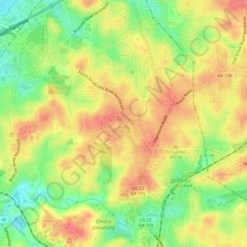
Name: North Druid Hills topographic map, elevation, terrain.
Average elevation: 291 m
Minimum elevation: 254 m
Maximum elevation: 319 m
Other topographic maps
Click on a map to view its topography, its elevation and its terrain.
Windwood
États-Unis d'Amérique > Géorgie > DeKalb County > Dunwoody > Windwood
Windwood, Dunwoody, DeKalb County, Géorgie, 30360, États-Unis d'Amérique
Average elevation: 307 m