
Río Verde topographic map
Interactive map
Click on the map to display elevation.
About this map
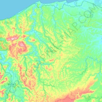
Name: Río Verde topographic map, elevation, terrain.
Location: Río Verde, Esmeraldas, Ecuador (0.56673 -79.51241 1.08684 -79.12078)
Average elevation: 132 m
Minimum elevation: 0 m
Maximum elevation: 620 m
Other topographic maps
Click on a map to view its topography, its elevation and its terrain.
Las Cumbres
Ecuador > Esmeraldas > Río Verde > Chontaduro > Las Cumbres
Las Cumbres, Chontaduro, Río Verde, Esmeraldas, Ecuador
Average elevation: 188 m