
Lero topographic map
Interactive map
Click on the map to display elevation.
About this map
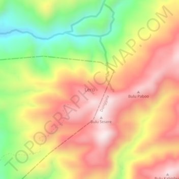
Name: Lero topographic map, elevation, terrain.
Average elevation: 602 m
Minimum elevation: 222 m
Maximum elevation: 911 m
Other topographic maps
Click on a map to view its topography, its elevation and its terrain.
Tongoa
Indonésie > Sulawesi central > Tongoa
Tongoa, Sigi, Sulawesi central, Indonésie
Average elevation: 1,130 m