
Ysperdorf topographic map
Interactive map
Click on the map to display elevation.
About this map
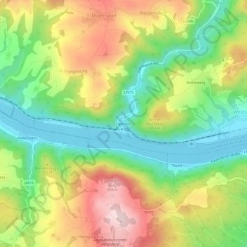
Name: Ysperdorf topographic map, elevation, terrain.
Average elevation: 369 m
Minimum elevation: 221 m
Maximum elevation: 565 m
Other topographic maps
Click on a map to view its topography, its elevation and its terrain.
Hofamt Priel
Österreich > Niederösterreich > Bezirk Melk > Gemeinde Hofamt Priel
Hofamt Priel, Gemeinde Hofamt Priel, Bezirk Melk, Niederösterreich, 3680, Österreich
Average elevation: 329 m