
Make a donation
Chinle topographic map
Click on the map to display elevation.
Make a donation
About this map
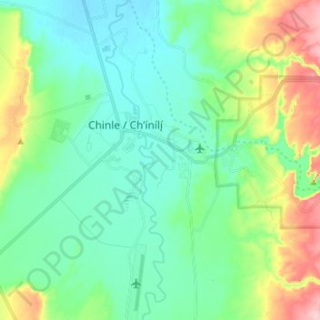
Name: Chinle topographic map, elevation, terrain.
Average elevation: 1,715 m
Minimum elevation: 1,659 m
Maximum elevation: 1,872 m
Make a donation
Other topographic maps
Click on a map to view its topography, its elevation and its terrain.
Alpine
United States > Arizona > Apache County
Located approximately 75 miles south of the Navajo Nation, Alpine was settled in 1876 by Anderson Bush, a European-American who built a log house there. He originally used it as a trading post known as "Fort Bush". Bush sold his holdings in 1879 to William Maxwell and Fred Hamblin, Mormon settlers who…
Average elevation: 2,510 m
Make a donation
Make a donation
Make a donation
Make a donation
McNary
United States > Arizona > Apache County
At an elevation of 7,316 feet (2,230 m), it is the second highest community in Arizona after Alpine.
Average elevation: 2,228 m
Make a donation
Make a donation
Make a donation