
Oberland topographic map
Interactive map
Click on the map to display elevation.
About this map
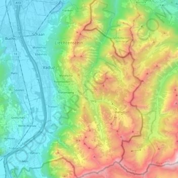
Name: Oberland topographic map, elevation, terrain.
Location: Oberland, Liechtenstein (47.04843 9.47167 47.19423 9.63571)
Average elevation: 1,237 m
Minimum elevation: 434 m
Maximum elevation: 2,837 m
Other topographic maps
Click on a map to view its topography, its elevation and its terrain.
Spiersbach
Spiersbach, Schellenberg, Wahlkreis Unterland, 9488, Liechtenstein
Average elevation: 495 m