
Thank you for supporting this site ❤️
Make a donation
Make a donation
Hengke topographic map
Click on the map to display elevation.
Thank you for supporting this site ❤️
Make a donation
Make a donation
About this map
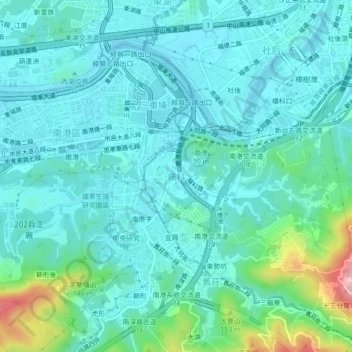
Name: Hengke topographic map, elevation, terrain.
Location: Hengke, New Taipei, 221004, Taiwan (25.02957 121.60036 25.06957 121.64036)
Average elevation: 44 m
Minimum elevation: -3 m
Maximum elevation: 244 m
Thank you for supporting this site ❤️
Make a donation
Make a donation
Other topographic maps
Click on a map to view its topography, its elevation and its terrain.